In one of our earlier projects, we requested pictures, stories, and other information about buildings and locations that went underwater when Lake Norman waters rose in 1963. The map you see below is the information the community shared.
Under Lake Norman
loading map - please wait...
 | B - Building: Mill, Pioneer Home, Plantation House E - Historic Event: Battle, Exploration H - Historic Site: Camp, Cemetery, Farm N - New Site S - Structure: Bridge, Dam |
John Abernathy Grave  A single grave, belonging to John Abernathy, was discovered by Duke Power in 1958 as they began clearing land for the construction of the Cowan's Ford Dam and the creation of Lake Norman. On December 22, 1959, a self-professed descendant of John Abernathy consented to allow Duke Power to relocate Abernathy's remains to the Hills Chapel Cemetery in Stanley, NC. | |
Baker Cemetery  In 1961, Baker Cemetery was moved to its current location in the graveyard of the Centre Presbyterian Church in Mooresville, NC (3.5 miles northeast from its original location). | |
Robert Barkley Homestead 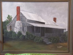 A homestead with farm and peoples | |
Beatties Ford Bridge  Beatties Ford Bridge, which carried the pre-Lake Norman route of Highway 73 across the Catawba River was demolished. | |
Beatty's Ford In 1749, John Beatty crossed the Catawba at a site that became known as Beatty's Ford. Beatty, an early landowner Scots-Irish pioneer, is one of the first white settlers to cross to the western side of the Catawba River. Beatties Ford Road, Beatty's Ford Park, and Beatties Ford Bridge (now under Lake Norman) are all named for John Beatty. | |
Blythe Family Farm This is the site of a two-story farm house, still standing, built for the Blythe family in 1848. The original farm, which is now largely under Lake Norman, was approximately 400 acres in size. | |
Buffalo Shoals Bridge  The Buffalo Shoals Bridge, which would have been inundated by the waters of the new Lake Norman, was torn down in late 1962, after the completion of a new, concrete bridge located immediately north of the old bridge. | |
Caldwell Family Cemetery In 1961, the Caldwell Family Cemetery, which would have been flooded by the waters of Lake Norman, was relocated from its original location to the McKendree United Methodist Church Cemetery in Mooresville, NC. The cemetery contained eight graves, all belonging to members of the Caldwell family. Gravestones ranged in date from 1833 - 1865. | |
Camp Fellowship  Camp Fellowship was opened on June 17, 1938. The Camp, located on the east bank of the Catawba River just North of the Buffalo Shoals Bridge, was created by Presbyterian Orphans' Home at Barium Springs for the benefit of the children under their care and of orphans housed at various other orphanages in the region. The summer camp operated under Barium Springs' leadership from 1938 until 1951, after which it was operated by the First Presbyterian Church for the benefit of local Boy Scout troops, until its closure due to the impending creation of Lake Norman. | |
Cedar Grove (Johnson) Plantation The plantation house of Houston Johnson, which is now under Lake Norman. The large log home was built in 1814 and demolished by a later owner in 1922-23. | |
Clark Family Cemetery In 1961, the Clark Family Cemetery, which would have been flooded by the waters of Lake Norman, was relocated from its original location to a new cemetery site on land owned, at the time, by Duke Power (35.6592, -80.9537). The cemetery contained thirteen graves, belonging to the Clark and Hill families. Gravestones ranged in date from 1813 - 1875. | |
Commodore Peninsula Land Sale This poster advertises for an early sale of lots on the new lake. | |
Cornelius Family Cemetery In 1961, the Cornelius Family Cemetery, which would have been flooded by the waters of Lake Norman, was relocated from its original location to the Rehobeth United Methodist Church Cemetery in Sherrills Ford, NC. The cemetery contained eight graves, all belonging to members of the Cornelius family. Gravestones ranged in date from 1827 - 1886. | |
Covington Family Homeplaces  This is the site of Elisha Benjamin's homeplace. He worked at the East Monbo mill. | |
Covington Family Homeplaces  This is the site of John Covington's homeplace. | |
Site of the Battle of Cowan's Ford 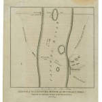 In February of 1781, Lord Charles Cornwallis, in pursuit of Nathanael Greene, engaged in a sharp fight at Cowan's Ford on the Catawba River. The Battle of Cowan's Ford claimed the life of North Carolina militia commander General William Lee Davidson, name sake of Davidson College, the town of Davidson, and Davidson County, NC. | |
Home Site of George Davidson Home site of early pioneer and Irish immigrant George Davidson (died 1760). Davidson moved to North Carolina from Pennsylvania in 1750. He was father to Revolutionary War General William Lee Davidson (1746-1781), who was killed at the Battle of Cowan's Ford in 1781 and for whom both Davidson College and Davidson County are named. | |
Davidson College Lake Campus 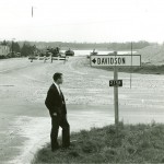 The Davidson College Lake Campus was created along with Lake Norman in the early 1960s. About 110 acres of property, that would become lake front land as the lake filled, were donated to the college by Duke Power as construction of the lake commenced. | |
East Monbo Mill and Village 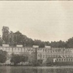 The East Monbo Cotton Mill closed in January of 1961 due to the formation of the Lake Norman. The lake overflowed onto both sides of the river, covering both the East Monbo and Long Island mills, both owned by Duke Power and operated by the Superior Yarn Mill company. | |
Elm Wood (Graham) Plantation A historic late Georgian style plantation house built by John D. Graham between 1825-1828, which is now under Lake Norman. | |
Flemming Family Cemetery In 1960, the Flemming Family Cemetery, which would have been flooded by the waters of Lake Norman, was relocated from its original location to the Rehobeth United Methodist Church Cemetery in Sherrills Ford, NC. The cemetery contained six graves, all belonging to members of the Flemming family. Gravestones ranged in date from 1814 - 1896. | |
William Harrison and Phillip Kelly Goodrum Family Home | |
Highway 150 at Lake Norman Marina This 1964 photo shows the new highway 150 as well as the old highway 150 at Lake Norman Marina. It is now Worth St. on one side and Fighting Creek Rd. on the other side of the lake. | |
Old Highway 150 Bridge  Old site of Highway 150 Bridge. The new Highway 150 bridge, which is 33 ft higher than the old one, was built about 100 feet North of the old bridge. | |
Hunters Chapel M. E. Zion Church Cemetery In 1961, the Hunters Chapel M. E. Zion Church Cemetery, which would have been flooded by the waters of Lake Norman, was relocated from its original location to the (new) Hunter's Chapel Methodist Church Cemetery in Cornelius, NC. The cemetery included twenty-one unmarked graves and fourteen marked graves, with gravestones ranged in date from 1833 - 1865. | |
Little Family Cemetery In 1960, the Little Family Cemetery, which would have been flooded by the waters of Lake Norman, was relocated from its original location to the Unity Presbyterian Church Cemetery in Catawba Springs, NC. The cemetery contained three graves, all belonging to members of the Little family. | |
Long Island Mill and Village 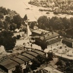 The Long Island Cotton Mill, owned by the Superior Yarn Mills company, closed on October 3, 1959 due to the formation of the Lake Norman. The lake overflowed onto both sides of the river, covering both the Long Island and East Monbo mills, both owned by Duke Power and operated by the Superior Yarn Mill company. | |
Long Island Mill Dam 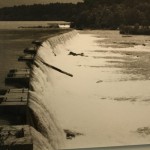 The growth of the Long Island Cotton Mill in the early 1900s led to a need for additional power. This need was met with the construction of a new a new concrete dam in 1919, which replaced the old log dam across the Catawba River. | |
McConnell Plantation Home Site Home Site and plantation house of early pioneer John McConnell, Sr. (1721-1801). McConnell was born in Ireland in 1721 and immigrated to the United States at the age of 19, arriving in Virginia in 1740. Between 1752 and 1761, McConnell received five Granville Land Grants totaling more than 2000 acres and an additional grant of 640 acres in 1778. In 1761, McConnell constructed his home (which became known as the McConnell Plantation) on the east bank of the Catawba River opposite to the location where Mountain Creek emptied into the river. | |
Monroe Patterson Bell Home The Monroe Patterson Bell family home was located about 1 ½ miles from the end of the present Bethel Church Road to the left and ½ mile back from the road. | |
John Oliphant's Grist Mill John Oliphant's operated a grist mill located on Oliphant's Creek from the 1750s until after Revolutionary War. The water-powered grist mill ground grain for early settlers and farmers in the Catawba River Valley. | |
Sherrill's Ford 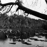 In approximately 1747, Adam Sherrill and his eight sons became the first documented white settlers west of the Catawba River. They crossed the river at a ford located in the middle of what is now Lake Norman. The ford subsequently became known as Sherrill's Ford. The town of Sherrills Ford, NC also takes its name from Adam Sherrill. | |
Underwater Airplane  On September 5, 2013, area firefighters using sonar technology discovered a submerged airplane. Coverage in local news media, include DavidsonNews.net reported several accounts on the possible origin of the plane and how it came to be underwater | |
Unity Church Road Bridge Unity Church Road used to cross over the Catawba River and link up with Bethel Church Road in Cornelius. The bridge was demolished during the creation of Lake Norman. | |
Home Site of Moses White Home site of early pioneer Moses White (emigrated to the U.S. from Ireland ca. 1742), located on the waters of Catawba and now under Lake Norman. White married a daughter of early pioneer Hugh Lawson. White was father to General James White (1747-1820), who founded of Knoxville TN, and grandfather to Hugh Lawson White (1773-1840) who served as a United States Senator for Tennessee and was a Whig candidate for President in 1836. |
