Category:Commons geocoding
Jump to navigation
Jump to search
English: Geocoding or Geotagging of articles, galleries, images and other media can be an alternative or complement to categories for organizing contents on the Wikimedia Commons.
See also:
- category:Media with locations -- added from the coordinate templates
- en:Wikipedia:WikiProject Geographical coordinates
- de:Wikipedia:WikiProjekt Georeferenzierung.
Subcategories
This category has the following 13 subcategories, out of 13 total.
C
G
- Galleries with coordinates (1 P)
- Geocoding overlays (1 P, 160 F)
L
- Location required (20 F)
- Location rounded (4746 F)
- Location withheld (764 F)
M
- Media with GPS EXIF (1523 F)
P
T
Pages in category "Commons geocoding"
The following 29 pages are in this category, out of 29 total.
!
- Commons:Coğrafi Kodlama
- Commons:Geocoding
- Commons:Geocoding/ro
- Commons:Geokoodaus
- Commons:Georeferenziazione
- Commons:Georeferenzierung
- Commons:Giorifirinziazzioni
- Commons:Géolocalisation
- Commons:Souřadnicování
- Commons:Souřadnicování/Postupy
- User:Sémhur/Brouillon
- Commons:ജിയോകോഡിങ്
- Commons:ジオコーディング
- Commons:地理编码工程
Media in category "Commons geocoding"
The following 19 files are in this category, out of 19 total.
-
 Afbeelding bij Locatie-coördinaten.jpg 2,362 × 1,721; 6.92 MB
-
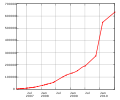 Commons geocoding graph.svg 600 × 500; 23 KB
-
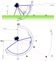
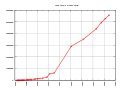 Commons geocoding.svg 800 × 600; 21 KB
-
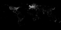
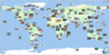
 Geolocated images in Wikimedia Commons 2012-01-21 remake.png 720 × 360; 17 KB
-
 Geolocated images in Wikimedia Commons 2012-01-21.png 720 × 360; 19 KB
-
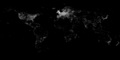
 Geolocated images in Wikimedia Commons 2014-02-21.png 720 × 360; 24 KB
-
 Geolocated images in Wikimedia Commons 2015-01-07.png 720 × 360; 25 KB
-
 Geolocated images in Wikimedia Commons 2016-04-16.png 720 × 360; 28 KB
-
 Geolocated images in Wikimedia Commons 2017-09-20.png 720 × 360; 38 KB
-
 Georeference 128.png 128 × 128; 15 KB
-
 Georeference.svg 39 × 40; 40 KB
-
 Georeference2.svg 44 × 44; 34 KB
-
 Georeference3.svg 101 × 42; 43 KB
-
 Pano-sketch3.svg 1,100 × 1,200; 28 KB
-
 Visual Editor coordinate bug showing while editing.png 1,841 × 597; 79 KB
-
 Wiki commons de animation 1990-2022.gif 933 × 818; 1.24 MB
-
 Wikidata-20150622-map-items-commonswiki-2880x1440.png 2,880 × 1,453; 59 KB
-
 Wikiminiatlas commons standalone 2.png 3,070 × 1,552; 3.05 MB
-
 WLZ Georeference.png 1,000 × 416; 83 KB