
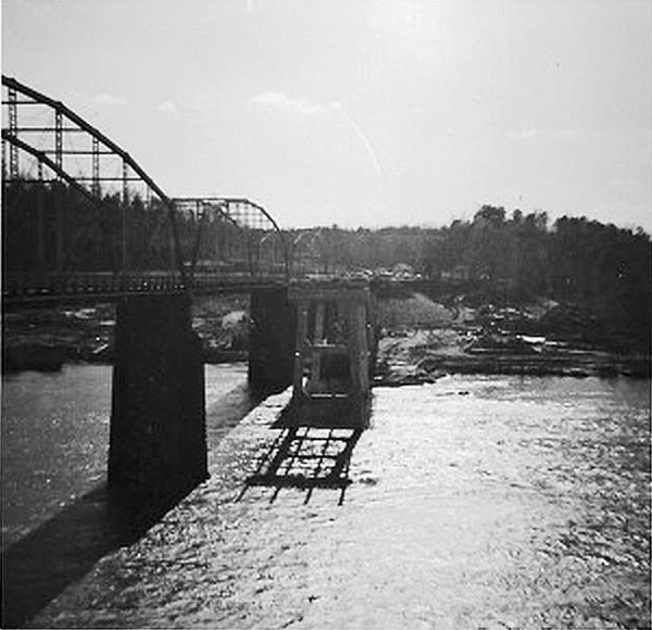
The original Buffalo Shoals Bridge (the first of its name) crossed the river about a mile north of the village of Long Island Village. The original bridge was washed away by the massive July 1916 flood. Immediate plans were made for the construction of a new bridge (the 1918 bridge), and, in the meantime, and ferry service was institutes to allow travelers to cross the river at that location. In October 1918, the second Buffalo Shoals Bridge was opened. The 1918 Buffalo Shoals Bridge was torn down in late 1962, after the completion of a new, concrete bridge located immediately north of the old bridge. The new Bridge is also called the Buffalo Shoals Bridge and is the third bridge across that span of water to bear that name. The 1918 Buffalo Shoals Bridge (the second of that name) would have been inundated by the waters of Lake Norman when the lake was flooded, which was the impetus for the construction of the 1962 bridge.
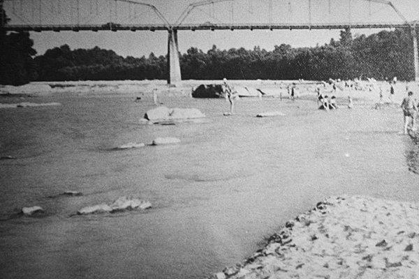
The first image shows the 1918 Buffalo Shoals Bridge with the initial 1962 Bridge foundations partially completed. The second picture shows the shoals area just upstream of the 1918 Bridge. Per the recollections of Ms. Ula Mae Brown this area was a favorite sun-bathing location prior to construction of the lake.
Location (approximate): 35.69531, -80.99188
Sources:
Anonymous submission via the Under Lake Norman website.
Buffalo Shoals Structure In Use Since Late 1918. 1961, Sept 16. “Buffalo Shoals Structure In Use Since Late 1918.” Statesville Record and Landmark, page 2.
New Bridge Opened. 1962, Oct 22. “New Bridge Opened.” Statesville Record and Landmark, page 2.