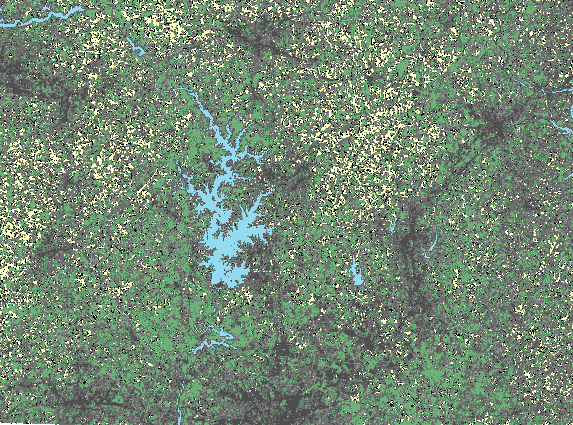
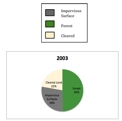
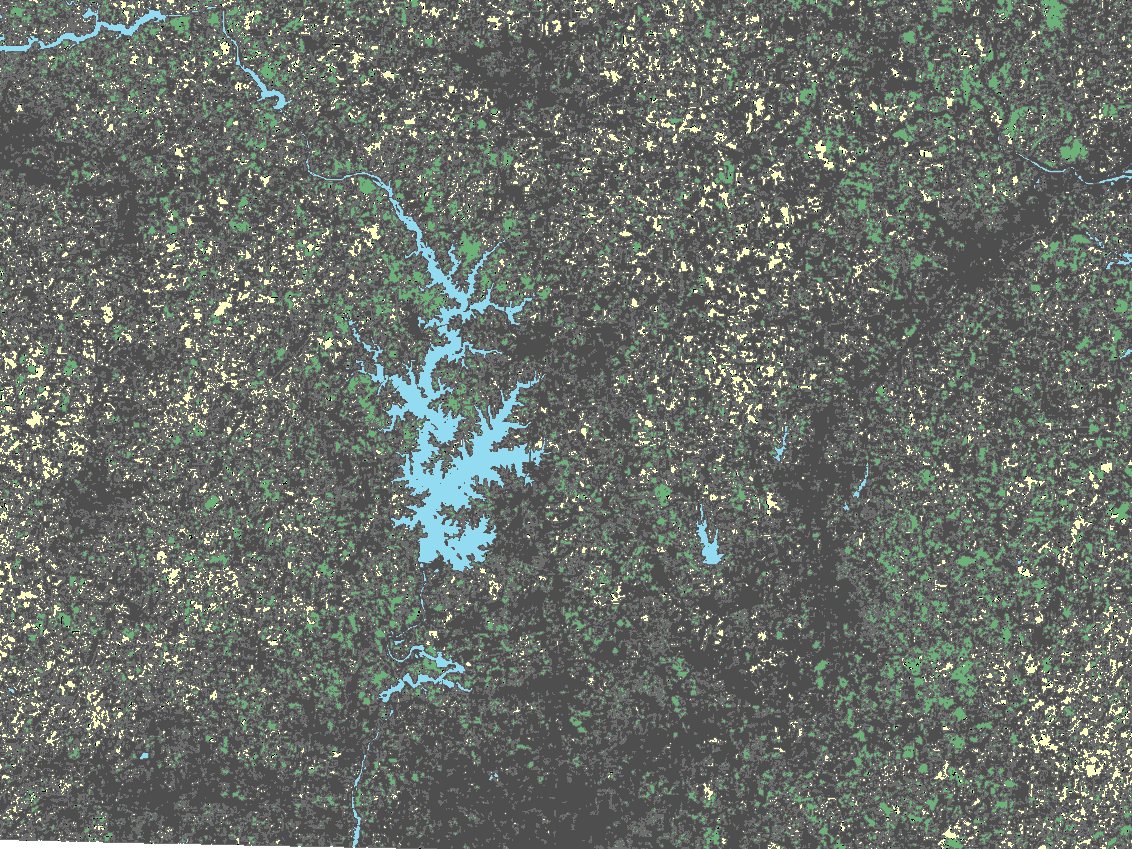
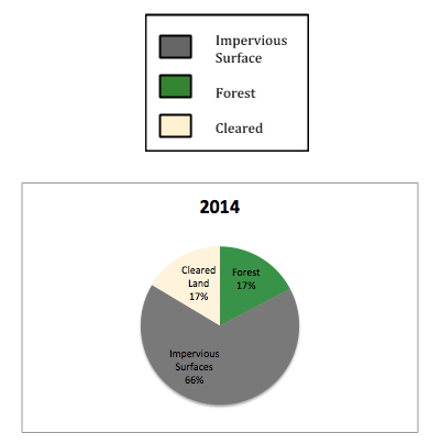
When examining the relationship between increased population levels and pollution in Lake Norman it is important to consider that most land-use changes are a result of increasing populations. The images below display two land-use mappings of the Lake Norman area from 2003 and 2014. Using aerial imagery from the two years, we classified landsat aerial images using ArcMap 10.1 and determined four main categories of land-use: impervious surfaces and buildings, forested areas, cleared areas, and water. From there we calculated the area of each category and determined that the area of impervious surfaces nearly doubled in ten years while forested area more than halved. According to Rick Gaskins of the Catawba Riverkeeper Foundation, more impervious surfaces exponentially increase the amount of runoff flowing into Lake Norman. Rick reported that an acre of forested land produces 0 gallons of runoff during a rainstorm as compared to the 18000 gallons of runoff produced for every inch of rain per acre in developed areas. High volumes of runoff– a direct result of development and land-use changes– can readily carry hazardous pollutants and sediment into Lake Norman.
In order to minimize subjectivity we conducted three classifications and calculated the averages; however, we recognize that this method remains somewhat subjective.
2003 Land-Use
2014 Land-Use
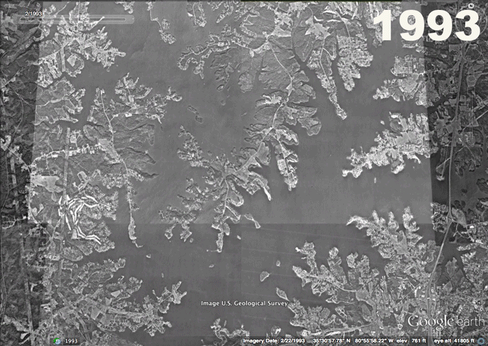
The animation below shows the massive development that took place between 1992 and 2014. Pay close attention to the changes in forest land. Unlike forested land, developed areas have very little ability to absorb pollution.